
Turn a San Clemente Street Address into an APN
A street-by-street search starts with the full situs address and moves toward the parcel. “Situs” means the physical location of the land or improvement. The APN then gives the County's tax, assessment, map, and recorded-document systems a stable key, even when a Spanish street type is abbreviated or a tract address is hard to match. The path is useful for the San Clemente street directory because it separates location evidence from later owner or occupant evidence.
- Enter the complete address in the Orange County Treasurer-Tax Collector search. The County describes property-address and APN search modes and requires JavaScript.
- Record the APN, situs, tax year or bill details, and any map link actually shown. If a result fails, try a standardized suffix such as Avenue, Calle, Camino, or Via without changing the underlying address.
- Open the official Assessor secured-value search and submit the eight-digit APN. Owner-name searching is not available on that form.
- Browse the County parcel map or San Clemente property map for the neighboring shapes. Cul-de-sacs, corner lots, condominiums, flag lots, and common-area parcels defeat simple house-number walking.
- Use eTRAKiT for address-keyed permits and projects, then ask the City for a focused permit history when details or older files are not online.
- Search RecorderWorks by an identified name, APN, document number, or legal description. Order an instrument only after the index supplies its identifier.
- For past households, consult local newspapers, directory volumes, census schedules, or Archives material with the historic address and legal description in hand.
The result is an evidence chain: address to APN, APN to map and tax context, identified party to deed index, and dated sources to occupants. It is not a claim that every person at the property will appear.
San Clemente Street Records and Their Keepers
Each record set answers a different address question. The tax search translates a street into a parcel. The Assessor's official page supplies a narrow roll snapshot. A deed index supplies indexed parties and document clues. San Clemente's Community Development system supplies permit and project history. A voter product may show approved street-level data only to an eligible requester with a permitted purpose. Historic directories and census schedules are dated snapshots, not a current block roll.
| Address-Keyed Set | Keeper | What It Shows | Access |
|---|---|---|---|
| Tax and parcel search | Orange County Treasurer-Tax Collector | Address-to-APN bridge, tax bills, payment context | Online; map and counter fallbacks |
| Secured assessment | Orange County Assessor | APN, assessed value, exemptions, basic parcel facts | Free APN-only form; counters |
| Recorded instruments | Orange County Clerk-Recorder | Grantor, grantee, date, type, number, map or book/page | Free index; paid copy route |
| Permits and projects | City of San Clemente | Work, status, applicant, builder, contractor, inspections | eTRAKiT, counter, email, or CPRA request |
| Historic directory and census | OCPL, Archives, NARA, genealogy collections | Listed or enumerated occupants for a dated period | Library, archive, or authorized collection access |
| Voter file products | California and Orange County election offices | Restricted registration and street-index fields | Self-status or approved order process only |
The parcel number ties tax, map, permit, and deed research together. The street name helps a searcher find the place, but the legal description and APN are safer continuity keys than a guessed sequence of house numbers.
Orange County Assessor Fields for a Street Search
The official Assessor form is deliberately less expansive than many property-search pages suggest. It accepts an eight-digit APN and returns basic secured-value information. The County says the web result omits owner name and does not permit owner-name searching. ParcelQuest is linked from the County's property-information page as an outside service, but the County did not publish its current public field set or tier details in the inspected material.
| APN | Required text input containing exactly eight numeric digits. |
|---|---|
| Submit | Runs the secured-value query. |
| Owner name | Unavailable; owner-name searching is barred and the owner is not included in the result. |
| Street address and ZIP | Not fields on this form. Use the Treasurer's address search or map to learn the APN first. |
| Roll date | The inspected result reflected the January 1, 2026 annual roll closure; later changes may not appear. |
For in-person help, the Assessor lists the Public Service Counter at 500 S. Main Street, 2nd Floor, Orange, 8:00 a.m. to 5:00 p.m. weekdays, and a South County satellite at Mission Viejo City Hall with the same published hours. The main number is 714-834-2727 and the South County number is 714-796-0217. A counter can help with assessment, property characteristics, and parcel-map questions, but online suppression rules should not be treated as an invitation to demand private fields.
- Parcel
- A mapped unit of land identified by an APN. One building can involve more than one parcel.
- Situs address
- The physical location of the land or improvement. It may differ from the tax mailing address.
- Legal description
- The tract, lot, block, or surveyed description used to identify land in a recorded instrument.
- Plat
- A recorded map showing a subdivision or parcel layout. It can resolve a street or lot relationship.
Browse San Clemente Parcels in eTRAKiT and GIS
San Clemente's eTRAKiT portal adds a local address layer to the County chain. The research inspection found anonymous general property, permit, project, and map searching. Detailed records and transactions are gated behind an account, and submitting an application is a different action from looking up a property. Use the public view to locate a project or permit number, then request the underlying record if the online display is too thin.
The County GIS and land-record route is useful for visual context. Pan along the actual street segment, click visible parcel shapes, and record each APN one at a time. A radius or buffer tool was not verified, so the San Clemente street directory should not promise a one-click list of every owner around a point. Opposite parcels, open space, common areas, and corner lots require judgment.
The eTRAKiT screen below shows why a street search can begin with a map but should end with a named, citable record.
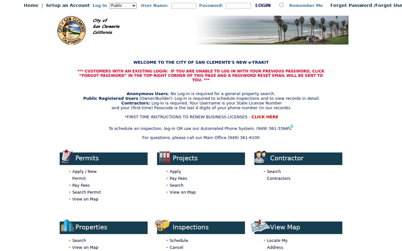
Map context helps locate the parcel and project. It does not turn an applicant, contractor, or permit contact into a confirmed occupant.
San Clemente Address and ZIP Verification
USPS is the cleanest first check when a street record has a spelling, ZIP, or city-label conflict. The USPS ZIP Code Lookup supports an exact address or a city-and-state search. It validates delivery geography; it does not identify residents, owners, or parcels. The core local ZIPs are 92672 and 92673, while some city planning data uses 92624 when approximating the city edge. A postal label is not proof of incorporation.
Preserve the exact recorded street spelling while testing variants. San Clemente's Avenida, Calle, Camino, and Via names can appear with abbreviations, and a planned tract may not follow a simple numeric grid. After USPS validation, check the City boundary or County map, obtain the APN, and only then send a municipal request. This prevents a County or City record from being assigned to the wrong jurisdiction.
The USPS address-and-city result is a delivery check, not a resident result.
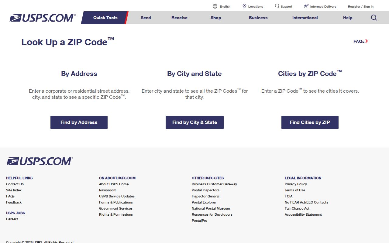
Once the ZIP is confirmed, use the APN and legal description for the durable record trail. ZIP codes are helpful filters, not substitutes for parcel identity.
Read San Clemente Permits by Address
A permit is an address-keyed clue about a physical change. San Clemente's permit instructions say a request for “permit history” can ask for permits, inspections, square-footage notes, the builder's name, contractors' names, or plans. The request should identify the street address and a date range. Plans and blueprints require a public-records request, and older or detailed histories may not be available through the anonymous portal view.
The City documents more than one access channel. Applications may use eTRAKiT, an in-person visit, or emailed PDFs. Community Development lists 949-361-6100 for help and 949-361-3366 for inspections. The Building counter publishes split weekday service, with question-only service later in the day and earlier last walk-in times. For a missing file, use the City's NextRequest portal or the CPRA page, naming an existing record rather than asking staff to compile a resident list.
- Search the address and note any permit, project, or inspection identifier.
- Separate applicant, owner, builder, architect, contractor, and site fields.
- Ask for the address's permit history, inspection records, square-footage notes, or plans by date range.
- Compare permit dates with deeds, directories, or census snapshots before describing a household change.
The captured building-permit source emphasizes the channel and instructions, not a complete resident index.
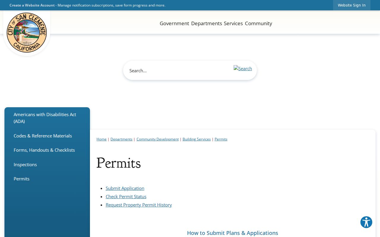
A permit can date construction or name a contractor. It cannot, by itself, establish who lived at the address.
From a San Clemente Owner to the Deed Index
Once an authorized property source supplies a name or an APN, RecorderWorks can turn the current clue into a recorded-document trail. Search surname first as grantee, then as grantor, and narrow the date range. A grant deed or quitclaim may be a candidate transfer. A deed of trust or reconveyance is financing context, not automatically a change in residence or ownership. Read the actual instrument before drawing a conclusion.
The Orange County index offers name, document number, document type, recording date, map, book/page, legal-description, and parcel modes. It displays an index entry, not a free document image. The copy route costs $1 per page and $1 for certification per document or map. For 1982-forward documents, use the recording year plus six-digit instrument number. For pre-1982 material, include book, page, and instrument when available. Mail requests go to 601 N. Ross Street, Santa Ana, with the required payment and a self-addressed stamped envelope. The Recorder will not search for the identifier on the researcher's behalf.
A deed chain can show recorded interests. It does not enumerate every household member, and an owner, trustee, entity, or mailing destination should not be relabeled as an occupant without separate evidence.
Past Households in the San Clemente Street Directory
The modern street directory owns the address chain; historical occupant work belongs to the older shelf. OCPL's San Clemente branch has a microfilm and fiche machine, local newspaper access, and genealogy databases with branch or card limits. NARA confirms San Clemente in Orange County city directories for 1926, 1929, and 1931. A normal alphabetical volume is name to address, so a street-first search may require a reverse or criss-cross section, a page-by-page read, or a librarian's help.
San Clemente's historic survey also cites March 1929 Sanborn maps. Those maps show building footprints and local services, not occupants. Pair a directory address with the 1930, 1940, or 1950 census, an obituary, a permit, or a deed event. Missing from one year can mean a move, an unlisted household, a spelling change, a publication gap, or a changed address. The fact needs an independent check.
- Criss-cross directory
- An address-first or street-order directory section, when a publisher included one. Local holdings and years must be verified.
- Householder snapshot
- A dated listing of a person or household, not proof of continuous residence.
- Index versus image
- An index points to a record; the image or volume supplies the wording and context.
When a street question turns into a name question, the San Clemente resident lookup workflow adds court, vital, and license cross-checks.
San Clemente Street Names and Tract Clues
San Clemente's street system carries its planned-community history. The original town centered on Avenida Del Mar and El Camino Real, while Rancho San Clemente, Talega, Marblehead, Shorecliffs, and other planned areas add curved streets, tract names, common-area parcels, and later electronic records. A modern number may not translate cleanly into a 1929 map or directory. Preserve the exact current address, then search the legal description, tract, lot, and APN.
Search variants should include Avenida and Ave, Calle and other Spanish street types, directional words, compound tract names, and initials in older names. Do not invent a renumbering year: the research did not verify one. City ordinances, subdivision maps, deeds, and Archives material are the right places to confirm a suspected change. APN and legal description are safer than forcing an old address into a current ZIP or street grid.
San Clemente Street Directory Limits
A street directory can show a parcel, an indexed party, a permit event, or a dated historical listing. It cannot reveal every person who shares an address. Recorded title usually names owners, trustees, entities, or parties to an instrument. The Assessor's official result omits owner names. DMV address information is restricted by the Driver's Privacy Protection Act. Utility customers, school records, delivery records, minors, and protected addresses are not general public street data.
Lawful use. San Clemente address records support focused personal research, family history, property curiosity, and civic review. Using names or addresses to stalk, harass, intimidate, or harm a person is prohibited and can violate California law.
California voter information has its own access rules. My Voter Status is an identity-gated self-lookup, while an Orange County Street Index or Walking List requires a signed order, permitted purpose, and payment. Neither route authorizes a casual block roster. Keep the San Clemente street directory narrow, cite the custodian, and state whether the evidence concerns a parcel, recorded party, or historical listing.
Request a San Clemente Property File
When a portal is thin, use the access channel that matches the record. The City Clerk's public-records route covers city-held permits, plans, inspection records, code or planning files, and administrative material. A CPRA request should name the address, department, record type, and date range. California Government Code §7922.535 gives an agency 10 calendar days to determine disclosure, with a limited 14-day extension for unusual circumstances. The determination date is not necessarily the delivery date.
For County records, send the request to the actual custodian. The Assessor has Orange and Mission Viejo counters. The Recorder offers index, counter, and mail copy routes after an identifier is found. Orange County Archives, in Old Orange County Courthouse Room 108, 211 W. Santa Ana Boulevard, Santa Ana, is open Monday-Friday 9:00-noon and 1:00-4:30 with a noon closure. A request or visit should ask for an existing record, not a custom address-to-resident investigation.
Record the trail. Save the query date, exact URL, APN, document or permit number, date range, response, and the fields actually visible.