
92672 and 92673 in the San Clemente ZIP Code Directory
USPS postal codes are delivery routes, not city limits. Census ZCTAs approximate ZIP geography for statistics, but a ZCTA is not the same as an exact delivery boundary. San Clemente's two core ZIP codes have different local clues, and nearby labels can appear in city datasets without placing a parcel inside the incorporated city. Use the coverage table as a starting map, then validate the exact address.
| ZIP | Areas Covered in Local Use | Post Office | Notes |
|---|---|---|---|
| 92672 | Downtown, village, Avenida Del Mar, coastal and central or southern San Clemente | San Clemente Post Office, 520 Avenida del Mar | Older-city and original-town clue; delivery territory can extend beyond a compact map |
| 92673 | Northern and northeastern San Clemente, Rancho San Clemente, Talega, newer hillside tracts | Rancho San Clemente Post Office, 905 Calle Negocio | Planned-development and modern permit or GIS clue |
| 92674 | San Clemente-associated legacy or PO-box code in routing publications | Current assignment not verified | Do not present as a residential street ZIP without address-level USPS confirmation |
| 92624 | Capistrano Beach and Dana Point postal area north of San Clemente | Not a San Clemente post office | Appears in some City datasets that approximate city limits; check jurisdiction |
The ZIP Code Directory is most reliable when it states what the postal clue can and cannot establish. A post-office address is not a parcel centroid, and a ZIP match is not proof of a person's current location.
92672: San Clemente's Original Coastal Core
ZIP 92672 is the useful first clue for the original coastal and village areas, including Avenida Del Mar and the older center associated with Ole Hanson's 1925 planned community. That geography tends to lead researchers toward early newspapers, the first directory-era sources, March 1929 Sanborn context, older permits, and longer deed trails. It does not mean every 92672 delivery address lies within the same historic tract or city boundary.
For an address in 92672, confirm the delivery line through the USPS address lookup. Then check the City boundary or County parcel map and obtain the APN. A historic address may use a different street abbreviation or business reference, so preserve the exact source wording. Pair the ZIP clue with the legal description, lot, tract, or map before connecting a name across years.
In a San Clemente ZIP code directory search, 92672 narrows the place and record era. It does not replace the deed, permit, directory page, census page, or court record that supplies the actual evidence.
92673: Rancho San Clemente, Talega, and the Hills
ZIP 92673 is associated with northern and northeastern San Clemente, including Rancho San Clemente, Talega, and newer hillside or planned-development areas. The record mix often leans toward tract maps, electronic permits, GIS parcel context, community-association geography, and modern recorded instruments. That is a research direction, not a claim that every street in the ZIP shares one development history.
The Rancho San Clemente Post Office is at 905 Calle Negocio, San Clemente, California 92673-9000, with the published phone 949-369-9392. Its USPS location page lists weekday retail hours of 9:00 a.m. to 5:00 p.m. and no passport service. The facility confirms a postal route and public service point; it does not define the entire ZIP boundary or identify residents.
When a 92673 address is used in a San Clemente ZIP Code Directory search, retain the tract and APN. Planned communities can contain common-area parcels, condominium units, and curved streets that make ZIP-only or house-number assumptions weak.
What 92674 Means in San Clemente Records
USPS routing publications associate 92674 with San Clemente as a legacy or PO-box-related code, but the research did not locate a current authoritative public page defining whether it remains PO-box-only or serves a residential street area. That gap must remain visible. A postal guide should not turn an old routing reference into a neighborhood boundary.
If a record contains 92674, run the exact address through USPS and preserve whether it is a PO box, delivery address, or historical label. Check the City or County parcel map next. A PO box identifies a mailing route, not the physical parcel where a person lives or where a deed is recorded. Use an APN or legal description for the land trail.
Verification rule. Treat 92674 as an address-level research clue until USPS confirms its current delivery meaning for the exact record.
The 92624 City-Line Mismatch
ZIP 92624 is associated with Capistrano Beach and Dana Point immediately north of San Clemente. Some City planning materials use 92624 in three-ZIP datasets that generally approximate city limits. That usage is evidence of a boundary problem, not a new core San Clemente delivery area. Postal city, ZIP, municipal jurisdiction, and census approximation can all differ.
A 92624 address should be tested through USPS, the San Clemente community or boundary map, and Orange County parcel geography before a City permit or records request is filed. If the parcel is outside the City, the City Clerk cannot be expected to hold its permit or code record. The same caution applies to business reports, voter products, and neighborhood maps that use a broad statistical area.
USPS Routes, City Boundaries, and Census ZCTAs
Three geography systems often get collapsed into one. USPS assigns a ZIP for delivery. A municipal boundary determines which City office handles permits, licenses, and City-held records. A Census ZCTA approximates a ZIP for statistical reporting. None of those systems alone shows who lives at an address. San Clemente's Neighborhood Watch and HOA map is useful because it overlays the City Boundary, residential associations, watch areas, and four watch districts, but it is not a ZIP map.
- Postal code
- A USPS delivery-area code. It can cross a municipal line and may include PO boxes or broad routes.
- ZIP+4
- A more precise postal extension for delivery sorting, not a resident identifier.
- ZCTA
- A Census approximation of ZIP geography used for statistics; it is not an exact USPS boundary.
- Carrier route
- A delivery path within postal operations. It is not a public household roll.
Keep these definitions beside the address record. The postal guide can narrow a search, while the APN and jurisdiction establish which record custodian applies.
Finding Residents by San Clemente ZIP Code
The California Unclaimed Property portal is the clearest official people-oriented ZIP search found in the research. It is a name-and-property tool, not a current residents directory. Search by exact last or business name or by Property ID, then narrow with optional first name, city, and ZIP. A 92672 or 92673 result describes a reported owner or last-known property connection. It does not prove current San Clemente residence.
| Last or Business Name | Text field; required unless Property ID is supplied. |
|---|---|
| Property ID | Text field; an alternative required search key. |
| First Name | Optional text narrowing field. |
| City | Optional text narrowing field; reported city may be stale. |
| ZIP filter | Optional text narrowing field; use 92672 or 92673 only as a filter. |
| Search and claim controls | Search displays exact matches before similar names; a claimant can select CLAIM and continue through the official process. |
- Validate the address and ZIP through USPS before choosing the city or ZIP filter.
- Search the exact name first, then test spelling or initial variants without merging records.
- Record the reported city, ZIP, Property ID, and result wording.
- Use a deed, APN, court, license, vital, or probate source to test identity.
- Do not pay an unsolicited finder when the official State Controller search is free.
The portal's ZIP field is useful for narrowing namesakes. It is not a public ZIP-by-ZIP list of residents.
Use APN when a San Clemente ZIP Is Ambiguous
ZIP geography becomes less useful around edge areas, planned communities, and old records. Translate the exact address to an APN through the County Treasurer-Tax Collector or map route. The Assessor's official secured-value page accepts eight numeric digits and omits owner name. RecorderWorks can then use the APN, legal description, map, or an identified party to locate an index entry. The APN is more stable than a ZIP label when an old street name or tract description changes.
For a 92672 or 92673 street, retain situs, mailing address, legal description, tract, lot, and APN as separate fields. A tax mailing address can be a PO box, manager, trust, or out-of-area address. It can help identify the owner trail, but it is not proof of an occupant. For street-level work, move to the San Clemente street directory address chain after jurisdiction and parcel identity are settled.
Post Offices for the San Clemente ZIP Code Directory
The San Clemente Post Office at 520 Avenida del Mar anchors the 92672 route. The Rancho San Clemente facility at 905 Calle Negocio anchors 92673 and publishes a direct phone and weekday retail schedule. Neither building is the geographic center of its ZIP, and neither post office can confirm a person's address. Use the exact USPS lookup for a street record.
The Rancho facility's official location page is the source for the local service detail.
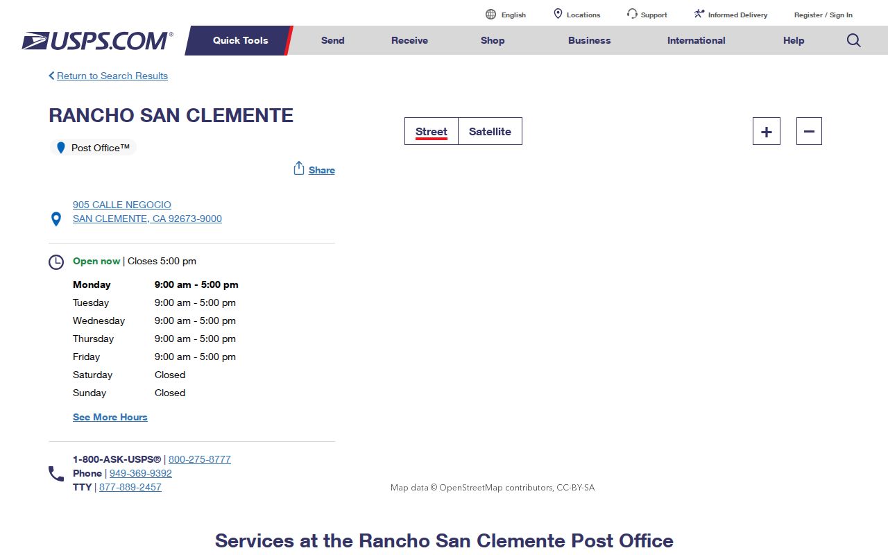
The image confirms the public postal-service route. The guide still needs parcel and jurisdiction checks before it becomes a records request.
ZIP Codes as San Clemente Record-Era Clues
Postal codes were introduced nationally in 1963, so a 1926, 1929, or 1931 San Clemente city directory could not use a ZIP as an original address key. Earlier continuity comes from street spelling, lot, block, tract, map, owner, and adjacent names. The old 92672 core is therefore a later geographic overlay on an earlier documentary trail.
Modern 92673 planned communities may lead to electronic permits, GIS, HOA geography, and tract records, while older 92672 research may lean on newspapers, directories, Sanborn maps, census schedules, and Archives material. These are useful tendencies, not hard rules. Search the record's own date and wording before assigning it to a ZIP era.
San Clemente ZIP Code Directory Limits
A ZIP code can describe delivery geography or a reported last-known address. It cannot establish incorporation, ownership, occupancy, household membership, or a current location. A public result may also be stale, suppressed, or tied to a PO box. Names, addresses, and voter fields have separate privacy and lawful-use rules.
Use ZIPs carefully. Narrow a family, property, or records question with 92672 or 92673, then confirm the address, APN, custodian, and record date before relying on a match.
For records that are not online, contact the actual custodian. San Clemente's CPRA channel covers City-held material; County offices handle deeds, taxes, court, Archives, and vital records; California offices handle statewide voter, license, privacy, and unclaimed-property systems.